Sunday, December 30, 2012

Skagit Valley & Padilla Bay Day Trip 10-20-12

Every fall, generally October, I make a day trip to the Skagit Valley with my Mom, who this year is 83 years young.  The main purpose of these trips is to buy flower bulbs directly from the grower.  But the Skagit Valley usually has additional plans for those inclined to wander and discover.  And so it was with this Skagit Valley day trip.  The one certainty is that these trips have bookends starting with a stop at The Donut House in Anacortes and ending at the Skagit River Brewery in Mount Vernon.  My donut of choice is the blueberry fritter, which at The Donut House is about the size of a standard frisbee.

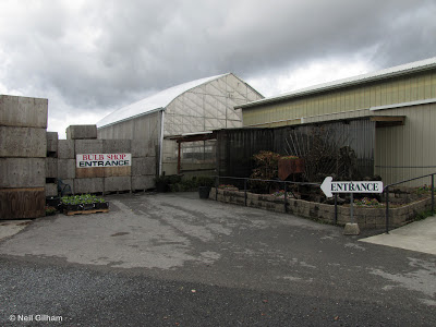
The Skagit Valley Bulb Farm (aka Tulip Town) is where we always buy the bulbs.  These are fresh, fat bulbs, unlike any you find on the rack at Home Depot.  Here you can also pick as many fresh, ripe apples as you can carry out from the rows of espaliered apple trees.

After our big bulb purchase, we decided to wander north.  When you roll through the Skagit Valley it's best not to have a plan, just drive along the roads and sooner or later something will pull you in.  And so it was with the Padilla Bay - Breazeale Interpretive Center.  The center has a small museum jam-packed with information about the ecology of Padilla Bay and the Salish Sea.  You get the feeling that eel grass is pretty much the crux of the ecosystem here.  The museum has several beautiful and impressive aquariums, well stocked with the local sea life.  This is all part of the Padilla Bay National Estuarine Research Reserve and so there's research going on here and a laboratory (not open to the general public).

We decided to follow the loop trail that begins just outside of the center at the edge of the parking lot.  The trail is about a mile in length and gently ascends through the upland area behind the center.  It's aptly named the Upland Trail.  It's an easy wide trail perfect for young kids and octogenarian mothers.  There was nobody on this trail when we were there on a cool cloudy wanting-to-rain fall day. 

We also explored the short trail to the beach that dives through a tunnel under the road with a final plunge on a spiral staircase that gets you right down on the beach.  We were here at high tide so there wasn't much beach.  At low tide Padilla Bay is a huge tidal mud flat.

The final stop was the Skagit River Brewery in Mount Vernon for good grub chased down with a glass of their Highwater Porter. 

In the Skagit Valley, go with the flow.  You'll never know where you'll end up.

Next photos:

 
It all starts at the Donut House in Anacortes.


Skagit Valley Bulb Farm

Skagit Valley barn.


Skagit Valley autumn colors on a row of old buckeye trees.

Padilla Bay - Breazeale Interpretive Center.

Amazing sea creatures ... found locally.

Red sea urchin

The Upland Trail at Padilla Bay - Breazeale Interpretive Center.
(derived from http://www.gmap-pedometer.com)

On the Upland Trail, looking back to the Padilla Bay - Breazeale Interpretive Center.

On the Upland Trail, looking out over Padilla Bay, the March Point refineries, and Mount Erie.

On the Upland Trail.

Friends you'll see on the Upland Trail.

The woods along the Upland Trail

 Fall rose hips along the Upland Trail.

 Dangers along the Upland Trail.

Take a rest on the Upland Trail.

Lummi Island from the beach access.

Great way to end the day.

Sunday, December 23, 2012

Ptarmigan Ridge - A Geology Field Trip 9-30-12

The Ptarmigan Ridge Trail begins Artist Point at the end of the paved Mount Baker Highway.  I had signed up for a field trip with North Cascades Institute to study the geology along the trail, with a focus on the Kulshan Caldera, a volcanic subsidence structure similar in origin to Crater Lake, but older, with the Crater Lake eruption at 7,200 years compared to 1.15 million years for the Kulshan Caldera.  The existing Mount Baker stratovolcano is a mere 40,000 years old.

The field trip was led by Dave Tucker, a director of the nonprofit Mount Baker Volcano Research Center and long time researcher of volcanic stratigraphy in the North Cascades with an obvious focus on the Mount Baker area.  I had been on several field trips with Dave, adding more to my knowledge base of North Cascades geology while discovering new places.  The field trip group consisted of a couple family groups and a few interested individuals like me.  We all met at the Glacier Public Service Center in Glacier, then bussed up from there to the trailhead at Artist Point.

The Ptarmigan Ridge trail is fairly level with a few gentle ups and downs.  For the first mile, the trail skirts the southern side of Table Mountain, offering unending views of Mount Shuksan, the subject of countless picture calendars.  Laid out below was virtually the entire scope of the Kulshan caldera, evidenced most by the white-colored ignimbrite exposed in gullies cut by the various streams that eventually coalesce into Swift Creek.  The ignimbrite is the lithified volcanic ash that filled the caldera to over a 1,000 meters deep.

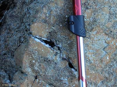
We made several stops along the hike to learn new things.  Rocks of the Chilliwack Group at 200 million years old were the oldest rocks we would see.   The Chilliwack Group represents oceanic island volcanic and sedimentary rocks brought in by plate movement as the Pacific Plate and North American plates collided, with the more dense Pacific plate diving underneath the North American plate, leaving behind and attaching the Chilliwack Group rocks onto the margin of the North American plate.  Picture a conveyor belt and you get the idea.  The Chilliwack Group rocks viewed here were a volcanic breccia of a beautiful shade of butterscotch cut with quartz crystal-filled fractures.

Most of the trail is on two andesite lava flows, the Table Mountain andesite lava (301 to 309 thousand years old) that sandwiches the Coleman Pinnacle andesite lava flow (305 thousand years old).  The the Coleman Pinnacle andesite differentiates itself with black hornblende crystals encased in the gray aphanitic matrix.  Along the way we observed polished and striated surfaces left from the passage of glaciers since melted away.

It was an absolute gorgeous day with barely a cloud in the sky, except a few wispy clouds on Baker's summit that later in the day developed into a full double-lenticular hat.  A faunal highlight was a mountain goat laying on a distant snowfield enjoying the sun.

 Now a few photos.


The morning start offered full, in-your-face views of Mount Baker.


 Detail of a volcanic breccia of the 200-million year old Chilliwack Group.

The Swift Creek ignimbrite (white), a lithified volcanic ash that filled the post-eruption Kulshan caldera 1.15 million years ago.

Glacial polish and striations on an andesite lava flow.

At 3 miles in, this is as close as we got to glacier-shrouded Mount Baker.  Coleman Pinnacle is the closer peak.  Backcountry skiers were making a few short runs on the sun-cupped tongues of snow below Coleman Pinnacle.


Mountain goat chillax.

Looking the way we came, into the North Cascades all the way into British Columbia.

The Mount Shuksan calendar shot.  Note the exposures of Swift Creek ignimbrite in the gulleys below the mountain.  Kulshan caldera includes just about the entire area seen below tree line.

On the way out looking back, Mount Baker grew a lenticular cloud hat.

Near the end of the road at Artist Point is this incredible contorted columnar andesite.

The route (adapted from http://www.gmap-pedometer.com/).

Saturday, October 27, 2012

Watson Lakes - September 16, 2012

The Noisy-Diobsud Wilderness at 14,133 acres is a comparatively small wilderness area as wilderness areas go.  What it lacks in size, it makes up by proximity to Mount Baker and North Cascades National Park, but more so in the shear impenetrability of its dense forests and steep slopes.  One single trail enters the Noisy-Diobsud and it is actually a pretty easy trail that ends at Watson Lakes, a pair of just beautiful classic North Cascades lakes.  A couple side trails lead off, one to Anderson Butte and the other to Anderson Lakes.

I decided to do this hike after perusing maps and wondering about potential hikes.  Watson Lakes stood out as being a little isolated from other potential hikes.  A little googling and searching of trip reports sealed the deal.  A perfect weather weekend was in store and that's all I needed for the go decision.

Getting to the trailhead involves driving up the Baker Lake Road off of Highway 20, the North Cascades Highway.  Off Baker Lake Road, right turn on Road 1106 to Kulshan Campground, and cross over the Baker Lake Dam.  After crossing Baker Lake Dam, which is pretty cool, pavement ends and you continue relentlessly uphill on a well-graded unpaved forest road (Road 1107).  The road is narrow so I was strategically and mentally logging potential pullouts for negotiating any opposite downhill traffic with some comfort knowing that uphill traffic has the right of way obligating downhill traffic to backup hill.  That's the theory anyway.

I finally reached the trailhead at 11 am, two hours after pulling out of my driveway, excluding the Starbucks stop at Cooks Road.  Plenty of parking at the trailhead, even on a sunny Saturday, maybe a dozen cars parked or less.
The trail starts out meandering through some shady old growth forest eventually breaking out into open meadow.  Here you hit the junction to Anderson Butte.  I stopped to take photos of the last of the season's meadow flowers.  My dog Ranger, as he always does, took the opportunity to gently squat down in the meadow streams to cool down.
 Climbing out of the first meadow, I turned around and was rewarded with stunning views of Mount Baker, the sleeping volcano.  At the other end of the first meadow, the trail again entered forest, crossed over a saddle and dropped down into another meadow.  The junction to Anderson Lake bore right here but I continued on toward Watson Lakes.

After crossing the meadow the trail entered forest again and climbed more steeply to another saddle.  The trail then dropped down into the Watson Lakes basin crossing the official Noisy-Diobsud Wilderness boundary.  The forest eventually opened at some large boulders offering a breathtaking view of the Watson Lakes pair  and beyond to glacier-draped Bacon Peak in the North Cascades National Park.
 I followed the trail around the northern side of the upper Watson Lake.  I paused and watched a gentleman fly fish from a float tube.  At the far end of the upper lake, I crossed its outlet stream and came to the lower lake.  This is as far as I went.  I turned around here stopping for lunch at a viewpoint overlooking the lower lake.  From here I retraced my steps back to the trailhead.  Approximate mileage was about 4.2 miles roundtrip.