Wednesday, May 8, 2013

Tilden Regional Park and the Upper Big Springs Trail 4-25-2013

In somewhat quick succession to my work trip to Reno in early April, late April had me down in the Bay Area.  The work day went quickly and my host, who was originally from Pakistan, treated me to lunch at a Pakistani restaurant in Berkeley.  He claimed it as the most authentic and delicious Pakistani restaurant in the area.  And it was.

Fortified with the huge lunch and a little daylight left I went for a short hike.  The Bay Area's eastern hills are blessed with a system of parks covering thousands of acres of open California hillsides traversed by miles of trails.  These parks are managed for our benefit by the East Bay Regional Park District.  I've always loved the Bay Area and these parks are a good reason why.

I only had a general idea of where I was going.  I had narrowed it down to Tilden Regional Park.  To get there, I drove around the backside on San Pablo Dam Road and then wound my way up and over San Pablo Ridge on Wildcat Canyon Road.  I made a left onto South Park Drive and stopped at the first trailhead I found.  I found it interesting that South Park Drive is closed from November 1 through March 31 to protect migrating newts.

The hike I did was a short one up the gentle climb of the Upper Big Springs Trail, which was more fire road than trail.  Soon after starting up the trail I spotted a short side trail to the left that led to a small quarry or borrow pit where the underlying basalt rock of the Moraga Formation was extracted and likely used for fill and roadbed material for the network of local fire roads turned to trails.  Soon I was at the crest of San Pablo Ridge with slit views of San Francisco Bay under the encroaching deck of evening low clouds, so typical a pattern of coastal California.  It was time to turn around as darkness approached.

This photo was taken from the side of Wildcat Canyon Road looking back to San Pablo Reservoir, created in 1919 to store water fed to it by an aqueduct from the Mokelumne River located far across across the Central Valley in the Sierra Nevada.

Eucalyptus trees are found throughout the east hills.  Originally brought over from their native Australia in the mid-1800s, they've gone wild, thriving in a similar climate as their homeland.

This is pretty much what the trail looks like.  I spotted some wild turkeys just up the hill.

Bluedicks (OK laugh and get over it), Dichelostemma capitatum, at least I'm reasonably sure that's what this is.  It's a favorite of mine because I had seen it so often in the Puente Hills of southern California, where I spent many days wandering and wondering as a youth.  It arises from a corm, which the California Indians gathered with digging sticks and ate.

I have no clue what this is.  I pored over my field guides, and I have a few but never enough and according to my wife, too many.  I'm going to take a WAG and call it some kind of milkweed.  Chime in if you know what it is.

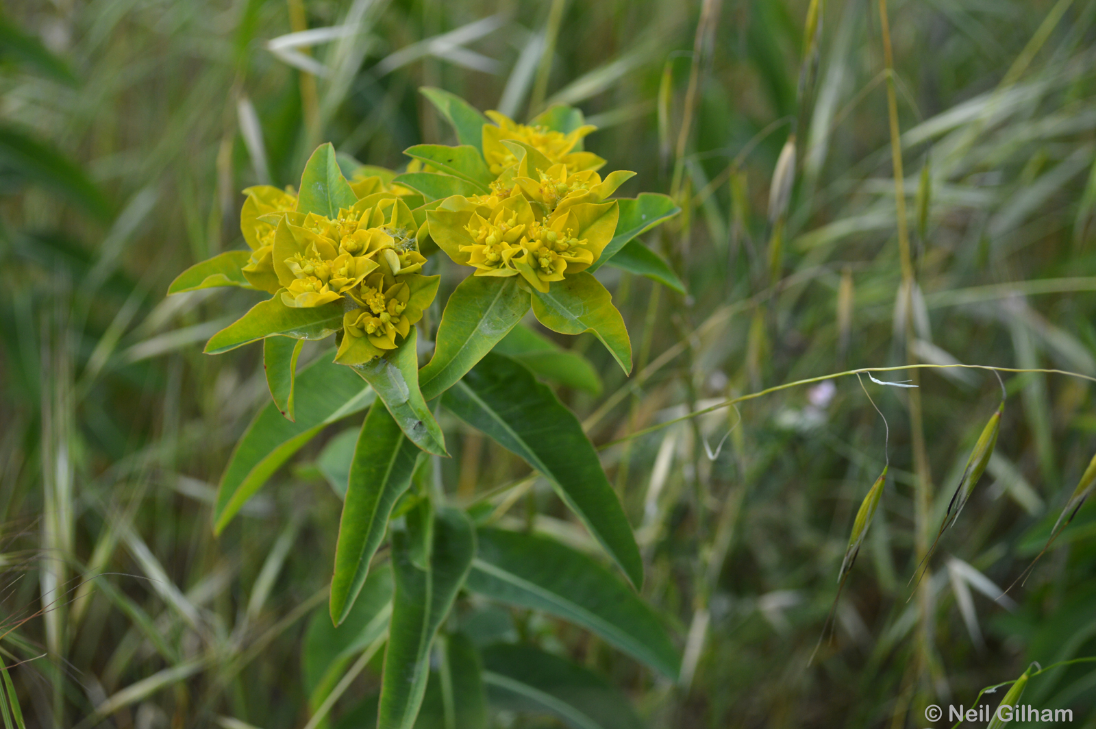
EDIT: On Twitter the kind folks at East Bay Regional Parks routed me to the folks at Regional Parks Botanic Garden who helped with this one.  As it turns out, this lovely plant is oblong spurge, Euphorbia oblongata, a California Department of Food and Agriculture class B noxious weed.  I did not recognize because it doesn't grow in Washington, except for two locations in the San Juan Islands and it apparently has not been found in southern California.  More here: RPBG - February 2011 Newsletter

White sage, Salvia apiana, found throughout coastal California.  This plant was also a food source for the California Indians.  The seed was a main ingredient of pinole, a staple food. The leaves and stems were eaten by the Chumash and other tribes.

This is the quarry face showing the massive basalt of the Moraga Formation.  Basalt, as you know from Geology 101, is an extrusive igneous rock formed as lava erupts, flows, and cools into a solid rock we know as basalt.  This particular basalt is about 10 million years old from a time period known as the Miocene epoch.  When the San Andreas fault system cut northward it cut through a tectonic plate, one that was subducting.  Basically the ass end of the plate was cut off but it kept moving.  The plate continued subducting leaving behind an opening, a "slab window" that allowed magma to flow up from the mantle and erupting from volcanic centers located to the west.  Tectonic forces later folded and uplifted these rocks.  This Moraga basalt underlies most of Tilden Park.


More eucalyptus trees.  They're everywhere.


At the crest of San Pablo Ridge where the Upper Big Springs Trail meets the Bay Area Ridge Trail.


Tempting

San Pablo Reservoir from San Pablo Ridge.

Under the cloud deck, San Francisco Bay and the Bay Bridge from San Pablo Ridge.

Tree skeletons left after a fire some several years ago.

The route, just a mile and half, round trip (adapted from gmap-pedometer.com).

Satellite view (adapted from gmap-pedometer.com).

Oblique view (adapted from Google Earth).